Photo: Kevin Lenz
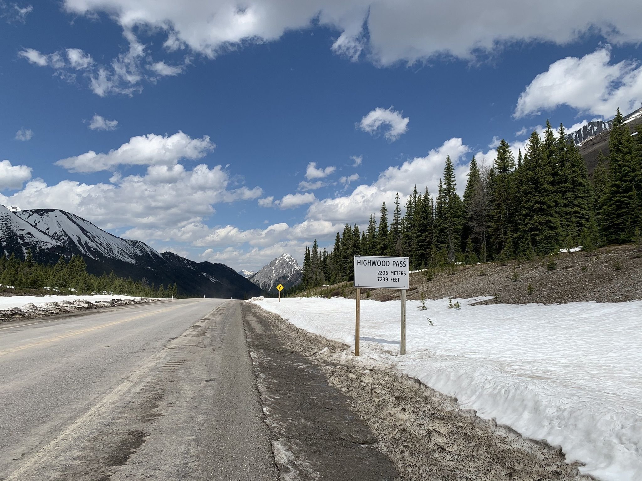
Without a doubt, Alberta is home to some of the most beautiful mountain scenery in the world. On such place is Highwood Pass, which also hold the title of Canada’s highest paved road with a summit at 2206 meter or 7239 feet. It is an amazing piece of highway that slices through Kananaskis Country. For cyclists the beauty of this ride is that prior to June 15th the road is closed to vehicular traffic. This gives you the opportunity to fully enjoy riding this, and the serenity of nature that this area has to offer.
Please be aware that if you plan on doing this ride prior to June 15th, that the weather is unpredictable, so prepare accordingly. It is not uncommon that riding this route in May, you will be greeted by snow the closer you get to the summit, sometime making it only possible to make it to the top by hiking the last few kilometers. Being Alberta, you can also get snow even after the road opens. Also note that in areas of this ride, you are likely to be out of cell phone coverage.
In this post we are going to focus on the South Climb, which has a greater elevation gain, but a lower average gradient. The South climb is an out and a back ride. Depending on where you park in comparison to the south gate will determine you ride, but overall you are looking at approximately 76km and a total of 1816m of elevation gain on your ride. May to June is the best time to get out and enjoy the climb, and if you search Facebook, often riders will share how close they get to the summit before they hit snow for earlier dates. Also note that the final weekend before the road opens is traditionally a very busy weekend to ride this route, but often adds to the atmosphere as there is always a large crowd of people at the summit reveling on their day’s accomplishment.

Elevation Map Highwood Pass

So make sure to bring enough water and food for your adventure, as there is nowhere on route to fuel up,. It is also important to note that you will notice a noticeable change in temperature between the base and summit. Even though you may not need a jacket or gilet for the climb, you are likely going to want to pack one. When we road this route it began snowing at the summit upon our arrival, and during the descent you notice the temperature quickly, just due to the fact that you are not working as hard.
It is also important to note that especially when the road is closed, that there can be a fair amount of wild life from goats to grizzly bears. Just be aware, and keep a respectful distance for any wild life. Just know on the descent that it isn’t uncommon for a pack of sheep to congregate on the road, so be aware on your descents. Bears are also frequent enough that groups will also pack some bear spray just in case.
Finally even after the gates open you can do this route, but just be known that the shoulder has seen better days in sections of this climb, and I for one would want to avoid descending in the shoulder. Ultimately nothing beats a great day of riding in the mountains. You can download the GPS data over on Kamoot, and if you do this ride please do share your experience, photos and video links in the comments below!